About GSGeo Professional Land Surveyors
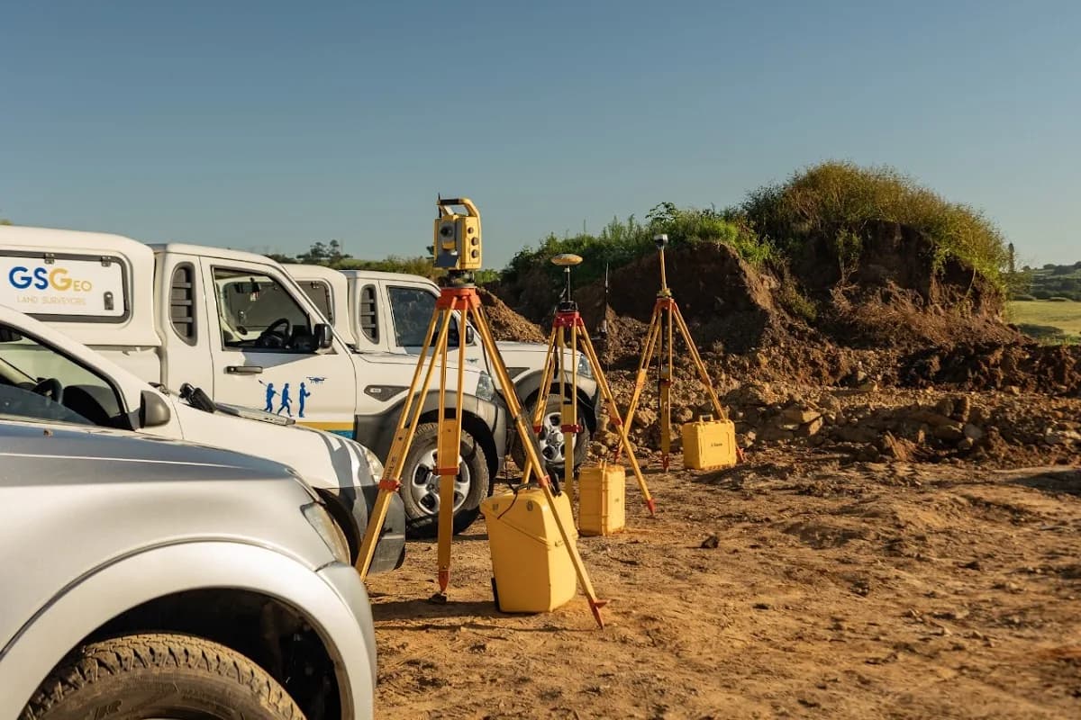
GSGeo Professional Land Surveyors is a specialist land surveying and geomatics firm in Salt Rock, Ballito serving residential property owners, developers, architects, engineers, municipalities, and the broader construction sector. Based on the Dolphin Coast of KwaZulu-Natal and operating across South Africa, GSGeo combines a strong technical foundation with a practical understanding of what clients need to move projects forward: accurate data, clear documentation, and reliable timeframes. Founded in 2018 and led by a professional land surveyor registered with the SAGC, GSGeo has delivered hundreds of cadastral and engineering survey projects in both the private and public sectors. From smallholdings and residential stands to complex township layouts and infrastructure developments, the team is known for being responsive, approachable, and highly efficient on site and in the office. Whether you are securing your property boundaries, navigating SPLUMA or subdivision requirements, or planning a new build along the Dolphin Coast, GSGeo Professional Land Surveyors in Salt Rock, Ballito provides the specialist surveying support needed to keep your project compliant and on schedule. ## Services & Specialties GSGeo offers a full range of professional land survey services tailored to property owners, developers, and legal professionals. Core cadastral offerings include beacon certificates, beacon relocation, subdivision and consolidation of land, general plans, and sectional title surveys. The team also prepares SPLUMA consent maps, high water mark surveys, and base plan maps for township design, and has the capacity to survey and submit servitudes, subdivisions, and consolidations to the Surveyor-General for approval. As registered sectional title practitioners, they support attorneys, managing agents, and body corporates with accurate sectional plans and practical advice on registration requirements. On the engineering side, GSGeo delivers detailed topographical surveys, as-built surveys, and plans for architects, engineers, and irrigation system designers, helping project teams to plan, design, and verify work with confidence. Services like piling setting out, building setting out certificates, and drone surveys using photogrammetry and LiDAR support the full lifecycle of construction, from initial concept through to final compliance. Their digital terrain models are enhanced with layers such as indigenous tree positions and names, giving architects and environmental consultants better tools to protect valuable natural features during development. GSGeo also provides specialised Geographical Information Systems (GIS) and laser scanning solutions. Using drone and satellite imagery, orthophotos, and historical imagery timelines, the team creates accurate mapping products and spatial datasets for clients across Southern Africa, including tribal authorities who require a clearer understanding of the layout of their land. Whether resolving encroachment disputes, documenting historical land use, or managing large rural holdings, GSGeo’s GIS and laser scanning expertise adds depth, precision, and visual clarity to land and asset management decisions. ## Why Choose GSGeo Professional Land Surveyors - Registered professional expertise: Managed by a professional land surveyor registered with the SAGC, GSGeo brings regulated competency and accountability to every cadastral and engineering survey.
- Strong track record across South Africa: With hundreds of completed projects in both urban and rural environments, the team understands real site conditions and the requirements of authorities across the country.
- Fast, responsive service: Clients consistently highlight GSGeo’s ability to mobilise quickly, meet tight deadlines, and complete urgent surveys on short notice without compromising on accuracy.
- Clear communication and guidance: Complex topics like servitudes, SPLUMA, sectional title, and encroachment are explained in practical, understandable terms so that clients can make informed decisions.
- Advanced survey technology: From modern GPS and total stations to drone photogrammetry, LiDAR, and laser scanning, GSGeo uses up-to-date tools to deliver precise, reliable survey data.
- Client-focused, on-site professionalism: Reviewers regularly praise the team’s punctuality, courtesy, and willingness to accommodate site-specific needs, whether on small residential plots or larger commercial and agricultural properties. ## Location & Accessibility GSGeo Professional Land Surveyors is based in Salt Rock, Ballito, on the KwaZulu-Natal Dolphin Coast, a convenient hub for projects across Ballito, the greater North Coast, and wider KwaZulu-Natal. The position near established residential estates, coastal developments, and key transport routes makes it easy for the team to reach both local construction sites and more remote rural properties, while clients in the construction and engineering sectors benefit from having an experienced land surveyor close to major growth nodes along the N2 corridor. ## Get in Touch If you need a land surveyor in Salt Rock, Ballito for boundary clarification, development planning, engineering set out, or GIS and laser scanning support, GSGeo Professional Land Surveyors is ready to assist. Reach out to discuss your project, request a quotation, or arrange a site visit, and work with a surveying team that combines technical precision with practical, on-the-ground experience across South Africa.
Business details
Business hours
Photos
Location
Frequently asked questions
GSGeo Professional Land Surveyors offers professional construction and engineering services. Contact us to request a quote or discuss your project requirements.